We have compiled a list of manufacturers, distributors, product information, reference prices, and rankings for Terrestrial Laser Scanner.
ipros is IPROS GMS IPROS One of the largest technical database sites in Japan that collects information on.

Terrestrial Laser Scanner - List of Manufacturers, Suppliers, Companies and Products | IPROS GMS

Terrestrial Laser Scanner Product List

1~3 item / All 3 items

Displayed results

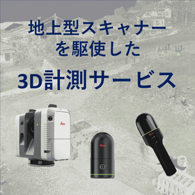
3D Measurement Service Utilizing Ground-Based Laser Scanners

We offer 3D measurement services utilizing ground-based laser scanners! We can accommodate various sites such as factories, plants, and fields.

We can acquire 3D point cloud data using our terrestrial and handheld laser scanners. Additionally, we offer GNSS surveying services and can accommodate requests for RTK surveying and static surveying as needed! 【Features of 3D Measurement Services】 - Smooth response from initial meetings to the field - Delivery of 3D point cloud data in the requested data format - Data delivery within as little as 2 business days (delivery time may vary depending on the size of the site). We have a proven track record in various scenes such as roads and fields. Please feel free to consult with us!

  • others
  • Terrestrial Laser Scanner

Added to bookmarks

Bookmarks list

Bookmark has been removed

Bookmarks list

You can't add any more bookmarks

By registering as a member, you can increase the number of bookmarks you can save and organize them with labels.

Free membership registration

3D Laser Scanner 【Trimble X12】

The Trimble X12 is a high-end terrestrial laser scanner with top specifications, including high precision, long range, high density, and automatic synthesis.

The Trimble X12 is a high-end terrestrial laser scanner capable of capturing 3D data with high precision, a best-in-class measurement range of 365 meters, and a scanning speed of up to 2,187,000 points per second. It also features a smart light function that allows for clear images to be captured in dark environments. The Trimble X12 combines the world-class scanner from Z+F with Trimble's proprietary Perspective software, which is intuitive to operate. By achieving "full automation" of the processes related to scanning tasks and point cloud synthesis, it allows many tasks that previously took a lot of time to be completed on-site, resulting in significant time savings, increased efficiency, and cost-effectiveness. The expertise that Trimble has cultivated in terrestrial laser scanning is now consolidated in this product.

  • others
  • Terrestrial Laser Scanner

Added to bookmarks

Bookmarks list

Bookmark has been removed

Bookmarks list

You can't add any more bookmarks

By registering as a member, you can increase the number of bookmarks you can save and organize them with labels.

Free membership registration

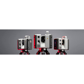
【2026 Latest Model】Leica RTC Series

Latest model announced in June 2026" - A ground-based laser scanner that enables "real-time data sharing during scanning.

The latest ground-based 3D laser scanner "Leica RTC500/700 Series" was announced by Leica Geosystems in June 2026. It overturns the conventional wisdom of "scanning on-site and checking data after returning to the office" in the fields of surveying, construction, and ICT civil engineering. With the industry's first new feature "Livelink," it seamlessly connects the field and the office, achieving overwhelming efficiency in surveying operations and reducing rework.

  • 3D measuring device
  • Terrestrial Laser Scanner

Added to bookmarks

Bookmarks list

Bookmark has been removed

Bookmarks list

You can't add any more bookmarks

By registering as a member, you can increase the number of bookmarks you can save and organize them with labels.

Free membership registration